नेपाली भूमिमा भारतले तटबन्ध बनाउन लागेको विरोधमा ग्रेटर नेपालले पठायो ज्ञापनपत्र

काठमाडौं, २०७७ माघ २ गते शुक्रबार
परराष्ट्रमन्त्री प्रदीप ज्ञवाली नेपाल भारत संयुक्त आयोगको बैठकमा भाग लिन गएकै दिन ग्रेटर नेपाल राष्ट्रवादी मोर्चाले नेपाल र भारतका विदेश मन्त्रीलाई एउटै बेहोराको ४ बुँदे ज्ञापनपत्र मेल गरेर पठाएको छ ।
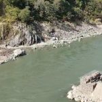
मोर्चाका अध्यक्ष फणीन्द्र नेपालले पठाएको ज्ञापनपत्रमा मुख्य रूपमा महाकाली नदीको पश्चिमी किनारमा भारतले तटबन्ध निर्माण सुरु गरेकोमा त्यो क्षेत्र नेपालको भएको हुँदा तत्काल यसलाई रोक्नुपर्ने माग गरिएको छ ।
२०७० सालमा आएको ठूलो बाढीका कारण काली नदीले धार परिवर्तन गर्दा काली पूर्वको नेपाली जमिन पश्चिमतर्फ परे पनि नेपाल र इन्डियाले स्थिर सीमा सिद्धान्त अपनाएका हुँदा त्यो जमिनमा नेपालको सार्वभौमसत्ता स्थापित भइरहेकोले नेपालले सुगौली सन्धिकालीन नक्साका आधारमा आफ्ना कुरा इन्डियासँग राख्नुपर्छ भन्ने तर्क ज्ञापनपत्रमा गरिएको छ ।
ज्ञापनपत्रमा त्यो नेपाली भूमि भारततिर पार्न त्यहीँ तटबन्ध निर्माण गर्न लागिएको भन्दै त्यहाँ भारतले हातहतियार चलाउन सैनिक तालिम केन्द्र बनाउँदा नेपाली जनता त्रासमा बाँच्नुपरेकाले त्यसलाई असैनिक क्षेत्र बनाउन पनि माग गरिएको छ ।
A letter of memorandum of Greater Nepal Nationalist Front to the Minister for Foreign Affairs, Nepal and External Affairs Minister, India respectively to immediately stop the construction of embankment on Nepalese territory in the western region of Kali River
Hon. Minister for Foreign Affairs
Mr. Pradeep Gyawali
Govt. of Nepal
Kathmandu, Nepal
Hon. External Affairs Minister
Mr. S. Jaishankar
Govt. of India
New Delhi, India
1. The Greater Nepal Nationalist Front has drawn serious attention to the embankment being constructed by India on the western bank of the Kali River, which flows between the Darchula District of Nepal and the Dharchula District of India. The Front would like to address this very issue to both the Foreign Ministers of Nepal and India It is worth mentioning that the Kali River is the western border of Nepal only until the Government of Nepal formally makes claims “Greater Nepal”. According to Article 5 of the Sugauli Treaty between the then British India and Nepal, the western bank of the Kali River is the border of Nepal.
2. The embankment that India is about to construct recently falls on the western bank of the Kali River just west of Khalanga, the district headquarters of Darchula district of Nepal, but the area under construction entirely belongs to Nepal. In fact, due to the great flood in the Kali River in 2070 BS, when the river had changed its course to the east, the Nepali territory fell to the west of the Kali River. This land of Bhorabgad was called “Birendra Forest” as it was planted trees by the then King Birendra himself. At the same place, there were a forest office, a sports office, a covered hall and an open stage. Half of the covered hall and one-third of the open stage land has already been cut off by the Kali River and the rest has been in Indian capture ever since. If India builds an embankment, that Nepali land will automatically belong to India.
3. Due to the negligence of the Government of Nepal, India has been utilizing Nepali land for its military training for a long time. As the Indian Army has made the area a training spot, the Nepalis who are living in a Nepali settlement east of the Kali River are always in the great panic of being shot someday by the Indian bullets. The constant gunfire by the Indian armies is making the area completely turbulent and toxic. Therefore, that territory should be made a civilian area immediately.
4. Since the recent problems are linked to geographical integrity as well as the sovereignty of Nepal, both the Nepalese and Indian governments must first clarify where the mainstream was during the Sugauli Treaty. It is an Indian attack on Nepal’s sovereignty to narrow the river and embank it without determining the extent of the Kali River on the then political map. Therefore, embankment construction work should be stopped immediately.
Phanindra Nepal
Chairman
Greater Nepal Nationalist Front
Kathmandu, Nepal
January 14, 2021


